
Walking a Midvale Street Record Trail
A street directory search works best as a chain, not as a claim that one database lists every household. Standardize the address first. Then use the Salt Lake County Assessor for the parcel and recorded owner, GIS for adjacent geometry, the Recorder for deeds and legal descriptions, voter data for an election-file match, and historical directories for a dated occupant lead. The parcel number connects several county systems, while a street name helps with directories and newspapers.
- Run the exact address through USPS, keeping the standardized city, state, ZIP, and ZIP+4.
- Find the parcel in the Assessor and save APN, situs, owner string, tax district, and legal-description clues.
- Open the parcel in GIS and record adjacent APNs, roads, layers, and subdivision or plat names.
- Search the Recorder by address or APN, then follow document dates, parties, types, and legal descriptions.
- Compare voter, directory, newspaper, tax-card, and map evidence only after labeling each source by date.
Assessor Fields for Midvale Streets
The legacy Salt Lake County query accepts an owner name, frontage number, street name or number, direction, street type, and parcel number. Owner Name needs at least three letters and may use “Doe, John.” A business name can behave differently from an individual name. The parcel route accepts the first ten digits, with optional final encumbrance digits. The first seven digits can return parcels on a block, so it can be a useful first sweep before checking each address.
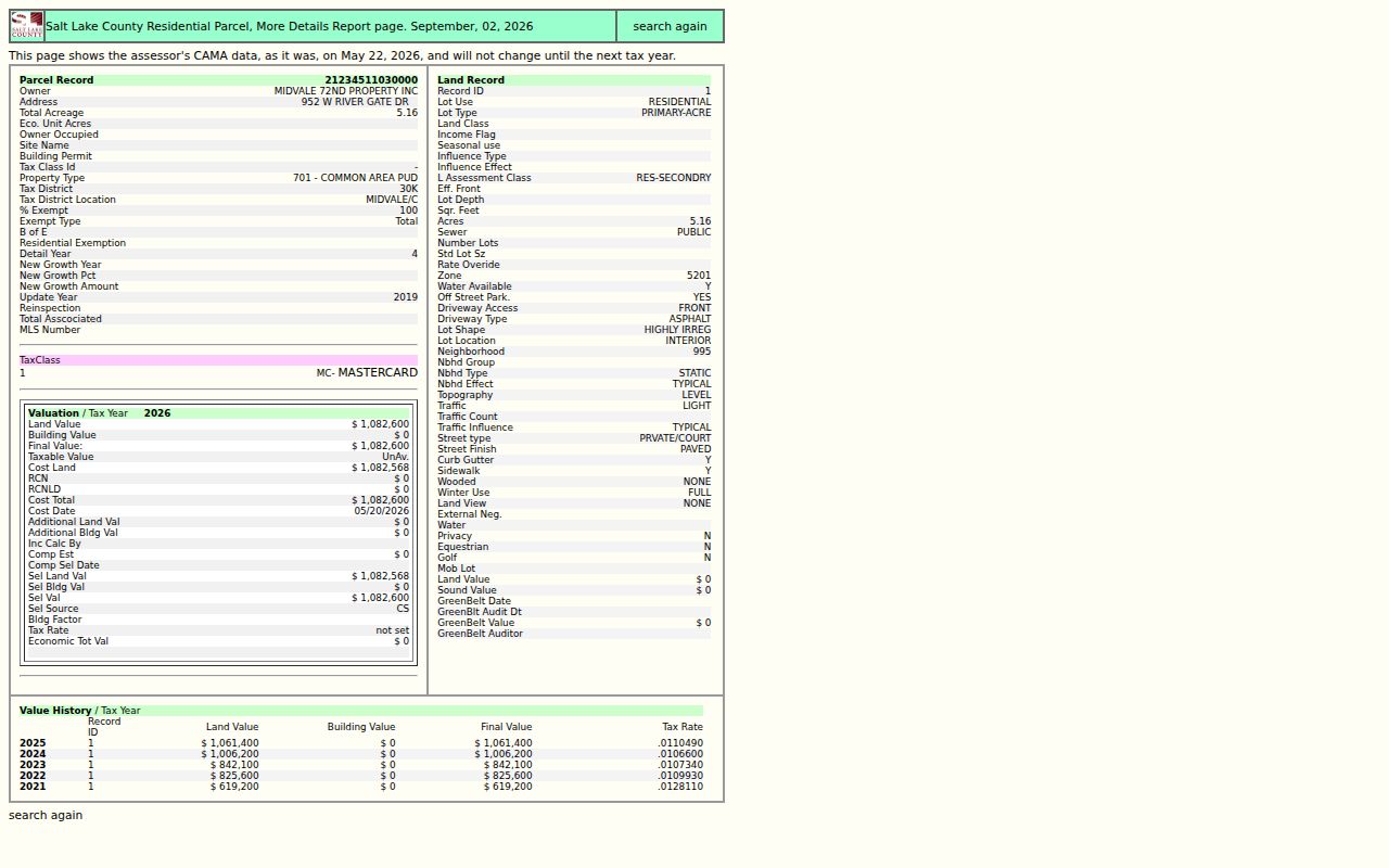
The result is property evidence. It may show parcel ID, owner, situs, acreage, property type, tax district, exemption, values, land record, and value history. A corporate owner, common-area PUD, exempt parcel, trust, or blank Owner Occupied field does not identify the household. Mailing address and situs address must remain separate.
| Owner Name | Three or more letters; recorded spelling and business-name limits apply. |
|---|---|
| Address | Frontage, street, direction, and type fields; at least a frontage or street name. |
| Parcel number | First ten digits, optional final four; first seven can browse a block. |
| Returned fields | Owner, situs, acreage, tax district, exemption, values, land record, and history. |
The Assessor legacy query shows the address and APN controls.
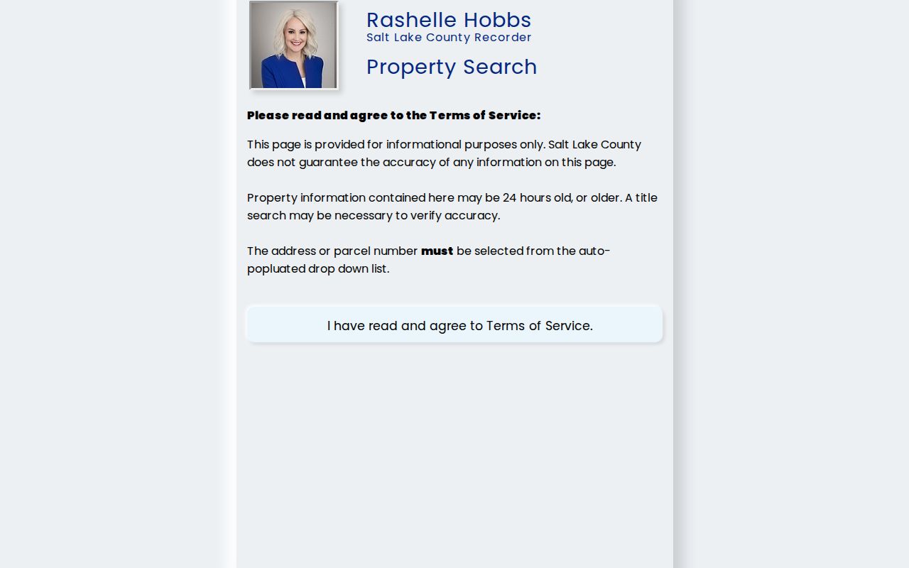
Autocomplete matters because the county public Recorder search also asks the user to select a recognized address or parcel rather than rely on free text alone.
Map a Midvale Parcel Block
GIS gives the street directory its physical frame. Start with the Assessor result, select the parcel in the Salt Lake County Assessor Parcel Viewer, and inspect the outline, APN, roads, tax districts, nearby parcels, and available aerial or oblique imagery. The county describes parcel information as connected to recorded plats and legal descriptions. Those layers can test whether a historic road or settlement label fits a modern Midvale location.
Do not read the map as a resident roster. A canal, common area, public tract, or road can sit between two addresses that look close in a search result. Open each adjacent parcel separately and preserve the owner string, property type, and date from its own detail page. Planning neighborhood names such as Old Town, Jordan Bluffs, Copperview, North Union, or Bingham Junction are useful search terms, not legal parcel boundaries.
The Salt Lake County Parcel Viewer demonstrates the selected-parcel map context.
Use parcel geometry to choose the next record, not to infer who is inside a building or behind a mailing address.
Midvale Records Searchable by Street
Address-keyed records answer different parts of a street question. The Assessor supplies a parcel anchor and tax context. GIS supplies geometry. The Recorder ties an APN or legal description to instruments. Archives holds tax cards, ledgers, maps, and photos. Directories and newspapers place people or organizations at a street for a period. Voter data can be checked as an election-file match, but its protected fields and file date must remain visible.
| Record Set | Keeper | What It Shows | Access |
|---|---|---|---|
| Property / tax roll | Salt Lake County Assessor | Owner, situs, mail-to, values, exemptions | Free portal |
| GIS parcel map | Assessor GIS | Parcel geometry, roads, adjacent APNs, layers | Free viewer |
| Deeds and liens | Salt Lake County Recorder | Parties, dates, instruments, legal descriptions | Index, paid images/options |
| Voter record | Utah and county Elections | Public address, ZIP, precinct, status, vote history | Privacy rules apply |
| City file | Midvale custodian | Permit or planning lead if maintained | GRAMA request |
The APN ties the property roll to deeds and map layers. The street name ties the parcel to directories, newspapers, and USPS. City building-permit access is a research gap, so identify the parcel and ask Community Development whether a narrow file is maintained before filing a Midvale GRAMA request.
Midvale Deeds by APN
RecorderWorks is the street directory’s title-facing tool. Its modes include name, map, document number, book and page, recording date, document type, APN, and legal description. The person index is described from 1986 to the present. APN deed search is described from March 3, 1997 to the present. The public Data Services search requires terms acceptance and an address or APN selected from autocomplete.
Capture document number, recording date, instrument type, grantor, grantee, legal description, book or page, and whether an image is available. The county sample result showed 29 documents and a current owner of record, while images were paid. A deed party is not automatically an occupant. For older streets, move from online names to archived abstracts, plats, grantor/grantee indexes, and the Real Estate Atlas.
The Salt Lake County RecorderWorks index shows the search modes available for a Midvale address.
The image is an access reference. Verify the live service’s fee and image rules before promising a copy or a complete title search.
Old Midvale Streets Need Translation
Official research did not locate a complete Midvale street-renumbering schedule. That gap changes the search method. A modern street name may not be the wording used in a 1919 directory, a County Archives map, a plat, or a newspaper. Union Fort, Union, Main Street, and Bingham Junction can be locality or neighborhood terms. Retain the original wording before adding a modern interpretation.
Use a three-way check: the 1919 Polk street-system page, the County Archives RM-020 map finding aid and C-18.2 Midvale series, and the current Assessor legal description or GIS parcel. Sanborn maps can add building footprints, alleys, stores, schools, churches, and industrial context. They do not prove that every person at a building lived there.
Midvale Tax Cards by Address
Salt Lake County Archives appraisal cards bridge a current street directory and a past house. The documented card ranges cover 1934 through 1987 or 1991, with uneven years and incomplete digitization. A card may show owner or address, building type, stories, additions, square footage, year built, depreciation, garage, appraisal date, footprint, and photos. A later supplementary appraisal can contain colored-pencil notes, and a 1957 card may add insulation or air-conditioning details.
Search the tax-card route by address or parcel number. Earlier or missing cards may require an Archives request at 385-468-0820. Tax ledgers run from 1853 through 2021, with 1853 through 1870 online and later questions routed through Archives or the Treasurer. A card records property and assessment context. Pair it with a directory, newspaper, or voter source before calling someone an occupant.
Street Terms in Midvale Records
Several labels recur in the Midvale street directory trail. A parcel is the county’s tax and land unit. A situs address is the physical location used for assessment. A plat is a recorded map that lays out lots, blocks, roads, and legal descriptions. A criss-cross directory is an address-first section that can turn a street into a dated name lead.
- Situs
- The physical property location, which may differ from a tax mailing address.
- APN
- The county parcel identifier used to connect Assessor, GIS, and Recorder searches.
- Plat
- A recorded map and lot description used when street labels or numbers change.
- Criss-cross
- A street or address section in a directory, useful for a past occupant lead.
When a source uses “owner,” “occupant,” “mail-to,” “situs,” or “filed address,” keep that word in the worksheet. The distinction protects against the most common street-search error: taking a tax address or deed party and presenting it as the person who lives at the parcel. A directory can offer stronger period occupancy context, but it still has publication limits and shorthand.
Midvale Permit Records Need a Request
No official address-keyed Midvale building-permit lookup was located. The city’s conditional-use application shows that Community Development collects owner or authorized-agent information, a property-owner affidavit, site plans, elevations, and written responses to zoning standards. An application proves that a request was made, not that a permit issued or work occurred.
Start with the Assessor APN and GIS location. Ask Community Development whether the file is maintained, then submit a narrow GRAMA request by address, parcel number, permit type, and date range if necessary. The city may classify the record as public, private, protected, controlled, governed by another law, or not maintained. That fallback is more reliable than treating a planning PDF as a completed permit record.
Midvale’s request form asks for the requester’s name, mailing address, daytime phone, and email, plus a specific record description. It offers inspection or copies, a public-benefit expedited request, and a fee-waiver request. The agency-use portion records classification and authorization. A narrow request gives the custodian a clear street, APN, date range, and file type to review.
The planning application contact is Community Development at 7505 S Holden St, Midvale, with 801-567-7200 ext. 1022 and planning@midvaleut.gov. Treat that contact as a routing point. It does not establish that a permit file is public, complete, or searchable by address.
For street-level work, save a small audit trail: the USPS return, Assessor query terms, APN, GIS date, Recorder search mode, directory volume and page, and any GRAMA request number. This makes a by-address result repeatable when a portal changes or a county record is updated.
That record trail keeps the street directory tied to evidence.
Limits of a Midvale Street Directory
A street directory cannot show every person inside a parcel. Directories can omit children, renters, boarders, unlisted subscribers, and people who moved after publication. An Assessor owner may be a trust, corporation, HOA, common area, or mail recipient. A court-filed address may be old. Utah driver and motor-vehicle records are restricted, and utility or delivery-customer lists are not a public resident source.
Lawful use. Midvale address records support personal, lawful research, family history, civic understanding, and safety awareness. Do not use them to stalk, harass, intimidate, or harm anyone. Verify important claims with the named custodian.
Utah Safe at Home can substitute an address for eligible survivors, and voter At-Risk withholding can hide qualifying records. Do not combine a GIS parcel, voter field, deed party, and directory clue to defeat those protections. The safest conclusion is often “owner shown in the parcel record” or “listed at this address in the publication year,” not “lives here now.”